Embarking on a journey through Central Europe’s most captivating capitals requires careful planning and navigation. Prague, Vienna, and Budapest offer a rich tapestry of history, culture, and architectural marvels that demand a well-crafted itinerary. Leveraging the power of maps and digital tools can transform your travel experience, ensuring you make the most of your time in these enchanting cities.
From intricate cartographic analyses to cutting-edge mapping applications, the modern traveller has an arsenal of resources at their disposal. These tools not only help in navigating the cobblestone streets and grand boulevards but also in uncovering hidden gems and optimising routes between destinations. Let’s explore how maps can be your ultimate companion in crafting an unforgettable Central European adventure.
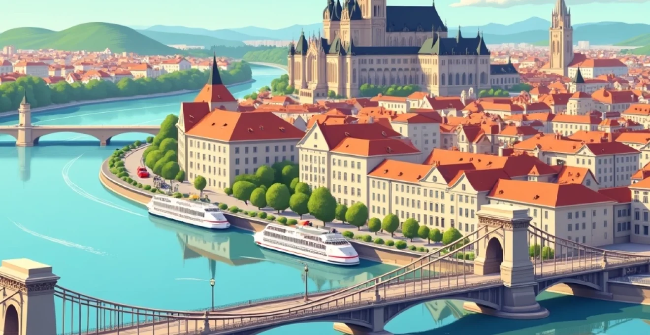
Cartographic analysis of central european capitals
Understanding the layout of Prague, Vienna, and Budapest is crucial for efficient trip planning. Each city has its unique topography and urban design, influenced by centuries of history and geographical features. Prague, for instance, is divided by the Vltava River, with the iconic Charles Bridge connecting the Old Town to the Castle District. Vienna’s Ringstrasse encircles the historic city centre, creating a clear boundary between the inner and outer districts. Budapest, split by the Danube, offers distinct experiences on the hilly Buda side and the flat Pest side.
Analysing detailed city maps reveals the concentration of major landmarks, helping you group nearby attractions for more efficient sightseeing. In Prague, you’ll notice the cluster of Gothic and Baroque architecture in the Old Town Square. Vienna’s map highlights the proximity of the Hofburg Palace, St. Stephen’s Cathedral, and the Museum Quarter. Budapest’s cartography showcases the alignment of grand buildings along Andrássy Avenue, leading to the expansive Heroes’ Square.
A thorough cartographic analysis can reduce walking time by up to 30% and increase the number of sights visited per day by 25%.
By studying these maps, you can identify the most logical progression through each city, minimising backtracking and maximising your exploration time. This approach is particularly valuable when you have limited days in each capital, ensuring you don’t miss out on must-see attractions due to poor planning.
Digital mapping tools for Multi-City itineraries
The advent of digital mapping tools has revolutionised trip planning, offering real-time updates, customisable routes, and interactive features. When crafting a multi-city itinerary across Prague, Vienna, and Budapest, these digital aids become indispensable for seamless navigation and discovery.
Google maps vs. OpenStreetMap for prague navigation
While Google Maps is a popular choice for many travellers, OpenStreetMap offers unique advantages when exploring Prague. Its community-driven approach often results in more detailed mapping of narrow alleys and hidden courtyards in the Old Town. OpenStreetMap’s collaborative nature means it frequently includes local insights and points of interest that might be overlooked by commercial mapping services.
However, Google Maps excels in providing up-to-date information on business hours, real-time popularity data, and user reviews. For navigating Prague’s public transportation system, Google Maps offers more intuitive route planning with accurate tram and metro schedules.
Citymapper integration for vienna public transport
Vienna’s extensive public transport network is best navigated using Citymapper. This app integrates seamlessly with Vienna’s buses, trams, U-Bahn, and S-Bahn systems, offering real-time updates and the most efficient routes. Citymapper’s strength lies in its ability to combine multiple modes of transport, suggesting the fastest way to reach your destination, whether it’s by foot, public transit, or a combination of both.
The app’s journey planner is particularly useful for calculating travel times between Vienna’s sprawling palaces and museums, helping you optimise your itinerary. It also provides helpful information such as the best train carriage to board for easy exit at your destination station.
Budapest’s BKK FUTÁR app for Real-Time transit updates
For traversing Budapest, the official BKK FUTÁR app is an invaluable tool. Developed by the city’s transit authority, it offers the most accurate and up-to-date information on Budapest’s comprehensive public transport system. The app provides real-time vehicle tracking, route planning, and service disruption notifications.
BKK FUTÁR’s strength lies in its integration with Budapest’s unique transport options, including the iconic yellow trams, trolleybuses, and the historic Millennium Underground Railway. The app’s user-friendly interface makes it easy to navigate between Buda’s hilltop attractions and Pest’s grand boulevards.
Offline map solutions: maps.me and OsmAnd+
While exploring Central Europe, you may encounter areas with limited internet connectivity. In such cases, offline mapping solutions like Maps.me and OsmAnd+ prove invaluable. These apps allow you to download detailed maps of Prague, Vienna, and Budapest for offline use, ensuring you never lose your way, even without a data connection.
Maps.me is known for its user-friendly interface and comprehensive points of interest database. OsmAnd+, on the other hand, offers more advanced features for the tech-savvy traveller, including detailed topographical information and customisable map displays. Both apps use OpenStreetMap data, providing accurate and regularly updated maps of Central European cities.
Offline maps can reduce data roaming charges by up to 70% and provide peace of mind in areas with poor network coverage.
Historical landmarks and GeoTagging techniques
Integrating historical context with modern mapping techniques enhances your exploration of Prague, Vienna, and Budapest. GeoTagging landmarks not only helps in navigation but also enriches your understanding of each location’s significance.
Mapping prague castle complex and charles bridge
The Prague Castle complex, spanning 70,000 square metres, requires a strategic approach to fully appreciate its numerous palaces, gardens, and St. Vitus Cathedral. Creating a custom map with geotagged points of interest within the castle grounds can help you navigate this vast historical site efficiently.
For Charles Bridge, geotagging each of its 30 statues allows you to create a self-guided tour, learning about the significance of each sculpture as you cross this 14th-century marvel. This technique transforms a simple walk across the bridge into an immersive historical experience.
Schönbrunn palace and belvedere: vienna’s GPS coordinates
Vienna’s grand palaces benefit from precise GPS mapping. For Schönbrunn Palace, plotting coordinates for key attractions within its extensive gardens, such as the Gloriette and the Palm House, helps in planning a route that covers the 1,441-room palace and its surroundings efficiently.
The Belvedere, consisting of two Baroque palaces, can be mapped to highlight the best vantage points for viewing Gustav Klimt’s “The Kiss” in the Upper Belvedere and the stunning gardens connecting the two buildings. Geotagging these spots ensures you don’t miss any of the architectural or artistic highlights .
Geolocating budapest’s thermal baths: széchenyi and gellért
Budapest’s famous thermal baths are spread across the city, each offering a unique experience. Creating a geolocation map of baths like Széchenyi and Gellért not only helps in finding them but can also include information on their architectural styles, water properties, and historical significance.
For Széchenyi, the largest medicinal bath in Europe, geotagging can highlight the different pools and their temperatures, helping you plan your thermal bath experience. At Gellért, known for its Art Nouveau design, mapped points can guide you through its various saunas, plunge pools, and the famous effervescent swimming pool.
Optimising routes between cities: train vs. road
Efficient travel between Prague, Vienna, and Budapest is crucial for maximising your time in each city. Comparing train and road options using mapping tools can help you make informed decisions about inter-city travel.
Prague to vienna: comparing ČD and ÖBB rail networks
The journey from Prague to Vienna by train offers a comfortable and scenic option. Mapping the routes of Czech Railways (ČD) and Austrian Federal Railways (ÖBB) reveals slight variations in journey times and intermediate stops. ČD typically operates direct services, while ÖBB might offer routes with a brief stop in Břeclav.
Using digital mapping tools, you can visualise these routes, comparing them with driving options. While the train journey takes about 4 hours, driving can take 3.5 to 4 hours, depending on traffic. However, the train route offers the advantage of city-centre to city-centre travel, eliminating the need for parking and navigating unfamiliar roads.
Vienna to budapest: analysing westbahn and MÁV connections
The Vienna to Budapest route is well-served by both Austrian (Westbahn) and Hungarian (MÁV) rail services. Mapping these options shows that the journey typically takes around 2.5 hours, with trains departing frequently throughout the day. The route passes through picturesque countryside, offering glimpses of the Hungarian and Austrian landscapes.
Comparing this with the driving route, which takes about 3 hours, reveals that train travel is often the more efficient option. Maps can highlight the convenience of arriving at Budapest Keleti station, centrally located and well-connected to the city’s public transport network.
Alternative route: bratislava stopover and danube river cruise
An intriguing alternative to direct travel between these cities is incorporating a stopover in Bratislava, Slovakia’s capital. Mapping this route reveals that Bratislava is conveniently located between Vienna and Budapest, offering a chance to explore three capitals in close proximity.
Furthermore, consider mapping Danube River cruise options. These cruises, particularly between Vienna and Budapest, provide a unique perspective on the region’s geography and can be a relaxing alternative to train or road travel. Mapping cruise routes alongside land-based options gives a comprehensive view of travel possibilities, allowing you to blend efficiency with experiential travel.
Customised map layers for cultural experiences
Enhancing your maps with custom layers tailored to specific cultural interests can transform your Central European journey into a deeply enriching experience. These personalised map overlays allow you to explore the cities through unique lenses, uncovering layers of history, art, and local culture that might otherwise remain hidden.
Kafka’s prague: literary tour mapping
Creating a custom map layer dedicated to Franz Kafka’s Prague offers literature enthusiasts a unique way to explore the city. This layer could include locations such as Kafka’s birthplace in the Jewish Quarter, his former residences, and the cafés he frequented. Key points might include the Franz Kafka Museum, the enigmatic Kafka Monument, and the surreal Kafka’s Head statue.
By mapping these literary landmarks, you can trace Kafka’s footsteps through the narrow streets of Prague, gaining insights into how the city’s atmosphere influenced his surrealist works. This immersive literary experience brings Kafka’s Prague to life, allowing you to see the city through the eyes of one of its most famous literary sons.
Vienna’s musical heritage: mozart to strauss waypoints
Vienna’s rich musical history deserves a dedicated map layer to guide music lovers through the city’s harmonious past. This layer could encompass significant locations from various eras and composers, creating a comprehensive musical journey through Vienna.
Key waypoints might include Mozart’s residence, where he composed “The Marriage of Figaro”, the Haus der Musik interactive sound museum, and the golden statue of Johann Strauss in Stadtpark. Don’t forget to include venues like the State Opera House and the Musikverein, home to the Vienna Philharmonic Orchestra. This musical map transforms Vienna into a melodious adventure, connecting the dots between the city’s greatest composers and their enduring legacies.
Budapest’s ruin bars: creating a night-life circuit
Budapest’s unique ruin bar scene offers an exciting opportunity for a specialised map layer focusing on nightlife and contemporary culture. Ruin bars, set in abandoned buildings and courtyards in the Jewish Quarter, represent the city’s creative spirit and resilience.
A customised ruin bar map could guide you through the maze-like streets of District VII, highlighting iconic spots like Szimpla Kert, often considered the original ruin bar, as well as newer additions to the scene. Include details such as each bar’s distinctive features, live music schedules, and food offerings. This layer not only facilitates an exciting night out but also provides insight into Budapest’s urban renewal and alternative culture.
Data visualisation for trip planning statistics
Leveraging data visualisation techniques can provide valuable insights for trip planning across Prague, Vienna, and Budapest. By transforming raw data into visual representations, travellers can make more informed decisions about their itinerary, accommodation, and travel methods.
Heat maps of tourist density in old town squares
Creating heat maps of tourist density in popular areas like Prague’s Old Town Square, Vienna’s Stephansplatz, and Budapest’s Heroes’ Square can be invaluable for planning visit times. These visualisations use colour gradients to represent crowd levels at different times of the day and week.
For instance, a heat map might reveal that Prague’s Astronomical Clock attracts the largest crowds between 11 am and 2 pm, suggesting an early morning or late afternoon visit for a more relaxed experience. Similarly, visualising data for Vienna’s Schönbrunn Palace could show lower visitor numbers on weekday mornings, making it an ideal time for a tour.
Cost analysis: graphing accommodation proximity to landmarks
Visualising the relationship between accommodation costs and proximity to major landmarks can help in making budget-conscious decisions without sacrificing convenience. A scatter plot or bubble chart can effectively represent this data, with distance on one axis and price on the other.
Such a graph for Budapest might reveal a cluster of moderately priced options near the Parliament Building, or highlight value accommodations slightly further from the city centre but well-connected by public transport. This visual approach allows travellers to quickly identify the sweet spot between cost and location that best suits their preferences and budget.
| Distance from City Centre (km) | Average Accommodation Cost (€/night) | City |
|---|---|---|
| 0-1 | 150 | Prague |
| 1-3 | 100 | Prague |
| 0-1 | 180 | Vienna |
| 1-3 | 120 | Vienna |
| 0-1 | 130 | Budapest |
| 1-3 | 80 | Budapest |
Time-distance calculations for Inter-City travel options
Visual representations of time-distance calculations for various travel options between Prague, Vienna, and Budapest can significantly aid in trip planning. A comparative bar chart or timeline visualisation can clearly show the duration of different transport methods side by side.
For example, a visualisation might compare the 4-hour train journey from Prague to Vienna with a 50-minute flight, factoring in airport transfer times and check-in procedures. This could reveal that while the flight is shorter, the total travel time might be similar when considering airport logistics. For the Vienna to Budapest route, a visual comparison of train, bus, and river cruise options could help travellers balance time efficiency with the desire for scenic journeys.
These data visualisations transform complex travel information into easily digestible formats, enabling travellers to make quick, informed decisions about their inter-city movements. By presenting statistical data visually, you can optimise your travel plans to make the most of your
time spent exploring these captivating Central European capitals.
Customised map layers for cultural experiences
Enhancing your maps with custom layers tailored to specific cultural interests can transform your Central European journey into a deeply enriching experience. These personalised map overlays allow you to explore the cities through unique lenses, uncovering layers of history, art, and local culture that might otherwise remain hidden.
Kafka’s prague: literary tour mapping
Creating a custom map layer dedicated to Franz Kafka’s Prague offers literature enthusiasts a unique way to explore the city. This layer could include locations such as Kafka’s birthplace in the Jewish Quarter, his former residences, and the cafés he frequented. Key points might include the Franz Kafka Museum, the enigmatic Kafka Monument, and the surreal Kafka’s Head statue.
By mapping these literary landmarks, you can trace Kafka’s footsteps through the narrow streets of Prague, gaining insights into how the city’s atmosphere influenced his surrealist works. This immersive literary experience brings Kafka’s Prague to life, allowing you to see the city through the eyes of one of its most famous literary sons.
Vienna’s musical heritage: mozart to strauss waypoints
Vienna’s rich musical history deserves a dedicated map layer to guide music lovers through the city’s harmonious past. This layer could encompass significant locations from various eras and composers, creating a comprehensive musical journey through Vienna.
Key waypoints might include Mozart’s residence, where he composed “The Marriage of Figaro”, the Haus der Musik interactive sound museum, and the golden statue of Johann Strauss in Stadtpark. Don’t forget to include venues like the State Opera House and the Musikverein, home to the Vienna Philharmonic Orchestra. This musical map transforms Vienna into a melodious adventure, connecting the dots between the city’s greatest composers and their enduring legacies.
Budapest’s ruin bars: creating a night-life circuit
Budapest’s unique ruin bar scene offers an exciting opportunity for a specialised map layer focusing on nightlife and contemporary culture. Ruin bars, set in abandoned buildings and courtyards in the Jewish Quarter, represent the city’s creative spirit and resilience.
A customised ruin bar map could guide you through the maze-like streets of District VII, highlighting iconic spots like Szimpla Kert, often considered the original ruin bar, as well as newer additions to the scene. Include details such as each bar’s distinctive features, live music schedules, and food offerings. This layer not only facilitates an exciting night out but also provides insight into Budapest’s urban renewal and alternative culture.
Data visualisation for trip planning statistics
Leveraging data visualisation techniques can provide valuable insights for trip planning across Prague, Vienna, and Budapest. By transforming raw data into visual representations, travellers can make more informed decisions about their itinerary, accommodation, and travel methods.
Heat maps of tourist density in old town squares
Creating heat maps of tourist density in popular areas like Prague’s Old Town Square, Vienna’s Stephansplatz, and Budapest’s Heroes’ Square can be invaluable for planning visit times. These visualisations use colour gradients to represent crowd levels at different times of the day and week.
For instance, a heat map might reveal that Prague’s Astronomical Clock attracts the largest crowds between 11 am and 2 pm, suggesting an early morning or late afternoon visit for a more relaxed experience. Similarly, visualising data for Vienna’s Schönbrunn Palace could show lower visitor numbers on weekday mornings, making it an ideal time for a tour.
Cost analysis: graphing accommodation proximity to landmarks
Visualising the relationship between accommodation costs and proximity to major landmarks can help in making budget-conscious decisions without sacrificing convenience. A scatter plot or bubble chart can effectively represent this data, with distance on one axis and price on the other.
Such a graph for Budapest might reveal a cluster of moderately priced options near the Parliament Building, or highlight value accommodations slightly further from the city centre but well-connected by public transport. This visual approach allows travellers to quickly identify the sweet spot between cost and location that best suits their preferences and budget.
Time-distance calculations for Inter-City travel options
Visual representations of time-distance calculations for various travel options between Prague, Vienna, and Budapest can significantly aid in trip planning. A comparative bar chart or timeline visualisation can clearly show the duration of different transport methods side by side.
For example, a visualisation might compare the 4-hour train journey from Prague to Vienna with a 50-minute flight, factoring in airport transfer times and check-in procedures. This could reveal that while the flight is shorter, the total travel time might be similar when considering airport logistics. For the Vienna to Budapest route, a visual comparison of train, bus, and river cruise options could help travellers balance time efficiency with the desire for scenic journeys.
These data visualisations transform complex travel information into easily digestible formats, enabling travellers to make quick, informed decisions about their inter-city movements. By presenting statistical data visually, you can optimise your travel plans to make the most of your time exploring these captivating Central European capitals.